Wednesday, July 31, 2013

July 31- Everton to Marshfield, Mo.

A challenging but enjoyable day.

We mostly walked our bike out the 1 mile (billed as 1/4 mile) gravel road from the Running Spring Farm to the paved road, and started east. The entire day's riding was up and down very sharp little hills. Innumerable 10% grades; even one 14%. We can just barely move on that steep a road, and if any of the hills were not short we would be cooked. As it was, we got over all of them, didn't have to walk any of them or stop to rest. Sandy remarked late in the day, "We're climbing hills I didn't think we could do!"

We stopped after a few miles for breakfast in Ash Grove, then for coffee at Walnut Grove, then for lunch at Fair Grove. All of them have their charms, but the central business districts were corpses. The pic below is Walnut Grove, but it could be any of hundreds of very small towns we've passed through. It's not a matter of WalMart sucking up all the retail business in a town. These towns have little or nothing instead of the dead 19th century main street. The lucky ones have a convenience store and an Ace Hardware on the outskirts. Pretty sad, but that's the situation. This whole trip has been a surprise to us in that way. It is routed through the empty quarter of every state we've visited, in order to take us on roads safe for cycling. But it has also given us a picture of rural America very different from what you see out the window at 70 mph on an Interstate. The people, however, are like people everywhere. Making the best of things, and finding ways to have fun. Along the Trans Am cycling trail, many place keep log books for cyclists passing through, and everyone is interested in our story.

Although the riding was hard today, we enjoyed it. Maybe we'll feel sick of it after a few hundred miles, but the terrain is very pretty: hardwood forests, small farms, and endless little hills to challenge us. Always something happening, and many small victories.

Marshfield is at an Interstate exit, with all the fast food and other familiar Americana you might imagine. We're staying at a Holiday Inn Express. We had dinner at a Mexican restaurant next door, and the cook either committed an error or a crime: I had the worst burn from spicy food ever, even including our trip to Thailand. But I got over it, there's a baseball game on TV, and all is well. Safely rest.

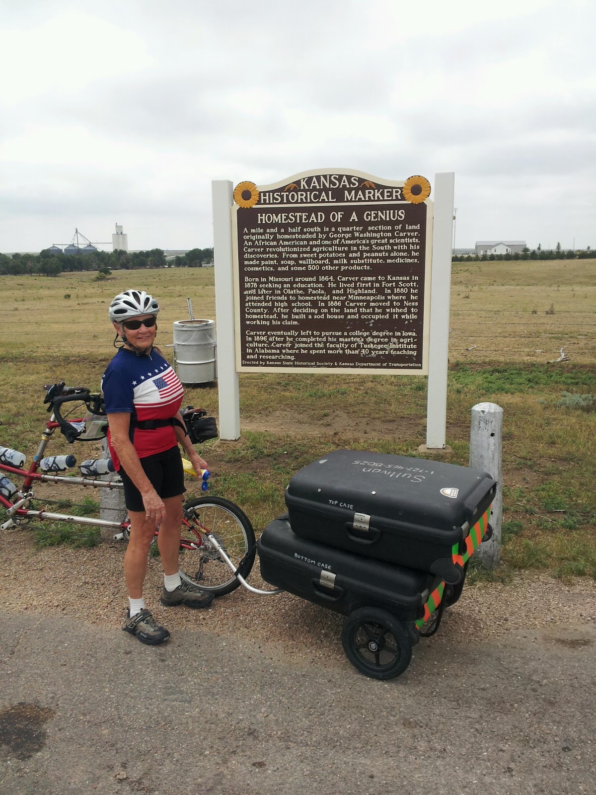
Today ends our eighth week of the trip, having logged 2712 miles, and 91236 feet of climbing..

Tuesday, July 30, 2013

July 30- Pittsburg, Kan. to Everton, Mo.

Wow- It took us eleven days to get across Kansas. We never shifted out of the large chainring, but all but 20 miles of it was into the wind. Nevertheless, as Dorothy said to Toto, "I think we're not in Kansas any more."

The storm which came through late last night was ferocious: incessant lightning and thunder, strong wind, and heavy rain. But by this morning the radar showed that it had moved past us to the east, so one more time we opted to move on rather than hunker down.

After breakfast our niece Carol drove us to a couple of chores we had been saving for a town as large as Pittsburg, Kan. Then we said goodbye to Carol and headed out of town.

Almost as soon as we left Pittsburg, we crossed into Missouri, and a funny thing happened: we got a tailwind. Not strong, but a welcome tailwind. The first since somewhere in Colorado.

We rode east past newly-green pastures, swollen creeks and overflowing ponds. There were storm clouds to our south, but we never got any rain.

We stopped in Golden City for lunch at Cooky's Cafe, which has been there since 1942. They had at least 20 kinds of pie on display, of which we regrettably could only try two.

About 40 miles into Missouri we ran into the Ozark hills like running into a wall. Small hills, but straight up and down. We discovered that we couldn't shift into the small chainring to get the gears we needed. Some clumsy on-the-road adjustments left us in the small ring, but stuck there. No matter, we pressed on.

The temperature was not extremely high today, but when the sun came out this afternoon it was a steam bath.

At Everton we sought out tonight's accommodation, the Running Spring Farm, a hunting preserve with a beautiful duplex lodge which caters to cyclists in the summer off-season. Getting here was a chore, up 1/2 mile of washed-out gravel road, but a beautiful spot, comfortable digs, and definitely the best choice in the area, since there was no other.

I spent quite a while trying to lube and adjust the derailleur, but I don't think I made it work any better. The bike has earned some professional attention, and I plan to call ahead to a bike shop in Farmington to let them know we're coming, maybe next Monday.

Monday, July 29, 2013

July 29- Chanute to Pittsburg, Kan

We weren't sure we'd be able to ride today, but when we woke this morning, the weather system which caused so much rain yesterday had shifted to the north. The roads were still wet, but no rain at all. We were happy to get on the road again.

A short distance out of Chanute, our road was closed because of construction on a new bridge. I asked for local knowledge at a nearby office, where we were shown how to get around the problem using local farm roads. After a couple of miles on those muddy roads our bike and cases looked like they'd just finished a mountain bike race.

The rest of the ride was uneventful, covering 60 miles to the big college town of Pittsburg. The treat at the end of the day was a visit from Sandy's niece Carol, who drove down from Kansas City to spend the evening with us. We went out for a good dinner, during which the weather caught back up with us. By the time we got back to the hotel we were in a full-fledged thunderstorm, which is crashing outside as I write. The bike is outside, but under the hotel's portico, so all is well.

July 29- Yates Center to Chanute, Kan.

Our first all-day rainy day.

We rode about a mile in a chilly rain to the church service we were lucky enough to find, then on to an excellent breakfast at Feed Bunk, rated RRR (Recommended by Rando Rob), then back to the motel to consider our options. In short, we didn't want to ride in the rain but didn't want to be stuck in a cheap motel all day. So we put on our rain pants and jackets and hit the road in a steady rain with the temperature in the low 60's. The chilly temperature was actually about ideal, since we didn't swelter in our rain gear.

Since we did almost 70 miles yesterday, today's trip was only 32 miles. We had a light headwind and the rain did not quit, but the trip was not arduous at all. At Chanute we quickly found a cheap but comfortable motel near the route, but the only food around was chain fast food. So we clogged our arteries and promised to eat healthier tomorrow.

Saturday, July 27, 2013

July 27- Cassoday to Yates Center, Kan.

Another day with surprises.

The rooster at Cassoday General Store did indeed announce the dawn. Repeatedly.

After breakfast at our generous hostess's Cassoday General Store we set out to Eureka, only 35 miles away. Wind was NE but the first 20 miles were south, so we made good time.

Along the way we met a westbound rider named Jeffrey (pic) who was pulling a trailer with a large dog named Bailey. Bikebaileybike is their facebook and twitter handle. He allows Bailey to get out and run alongside sometimes. I'd let him run a lot instead of carrying him. He was the first rider we've seen on the road in three days.

When we reached Eureka it was only 11:30, and we had second thoughts about stopping there. The dilemma was that the next town on the route with a motel, Chanute, is another 65 miles. The temp was only in the 70's, so riding conditions were pretty good, but the contrary wind would make it a long, hard 65 miles. We did want to get further along because the weather for Sunday and Monday sounds ugly. We didn't want to quit early and then get stuck for a day or two. But we also didn't want to camp part way to Chanute with bad weather threatening. So we looked online and found that we could go 32 miles on another route toward Chanute through Yates Center, which does have a motel. In fact, they have two. It doesn't add more than a couple of miles to the prescribed route. So here we are in a nice town but one we didn't expect to visit. If we do get stuck here by the weather, at least we are 32 miles farther along than Eureka.

This part of Kansas is called the Flint Hills, and is the only remaining large section of original prarie grass. It is beautiful country, with rolling hills and lush green grass fattening up many many cattle shipped here for that purpose. If you buy grass-fed Angus beef, chances are the steer enjoyed his last good days here.

One macro measure of our progress has been time zones. Another has been baseball teams on TV. We started with the Mariners, moved on to the Rockies, and for the last few days it has been the Royals. I don't know who's next- maybe the Cardinals. Regardless, it is fun. And back home, our Rays are on a tear, leading the league now after a very poor start for the season. They seem to do best on the road- when we're on the road, that is.

Friday, July 26, 2013

July 26- Newton to Cassoday, Kan.

More changes in the landscape today. Although no part of our route through Kansas has been completely flat the way most of Florida is, the gentle rolling hills are increasing. And today we transitioned from immense cornfields to open pasture with large numbers of cattle. All through the west most of the cattle we have seen have been black angus. I guess they command a premium: the power of marketing.

A broad storm system came through between 1 a.m. and 3 a.m. last night, with enough thunder and lightning to get our attention. But it was clear by morning and today's ride was in pleasant conditions: partly cloudy and not much wind.

Stopping places are scarce along our route in this area, even though there are Interstates and large cities like Wichita not far away. Today's goal was Cassoday, which turned out to be almost a ghost town. There is one general store, where we got a good lunch. We were resigned to camping in the town park, but the store owner (pic) generously offered the use of an exercise room on the property. She has often put up touring cyclists there before. We accepted her offer with gratitude because of possible thunderstorms in the forecast. The exercise room has multiple massage/therapy tables, two comfortable chairs, A/C, and even a couple of blankets if we should need them. We spent a lazy afternoon reading and napping, then back to the general store for an excellent pizza dinner. Luxury! One more time, we find ourselves where we never expected to be, and the beneficiaries of kind strangers.

The last few days we have been in a heavily Mennonite area. We have seen several families in which the women and girls dress plainly though the men do not. In this area, they use cars and machinery. One Mennonite woman supplies the store here with baked goods, and we have a loaf of zucchini bread set aside for breakfast tomorrow.

The store's owner here has a small coop of chickens and we've seen the rooster around, so we may be up early tomorrow, waiting for the store to open at 7 o'clock.

Thursday, July 25, 2013

July 25- Nickerson to Newton, Kan.

Today was a series of reminders that the Transamerica Bicycle Trail is a big deal to this part of the country.

Before leaving Hedrick's Animal Farm and B&B, we got a picture of the turkey with its ostrich friend. Truthfully, the turkey is more perceptive than we are to tell which ostrich is his buddy.

At the cafe in town where we had breakfast (Hedrick's breakfast was too late for our schedule), the owner had a cyclist logbook for us to sign and a map of the world where we put a pin on St. Pete Beach.

Riding conditions today were as near perfect as you can hope for. There is a large weather system moving across the country, with rain in northern Kansas and also in northern Oklahoma, with us in between; welcome cloud cover but no rain. There was no wind at all except for a slight headwind the last few miles, and the road surface was exceptionally smooth. The elevation even dropped slightly over the course of the day. So it was an easy 57 miles.

Newton, our destination town, has a population of 20,000 and is growing by 1000 per year. We stopped at the first Walgreens we've seen in a long while for a few needed items. Lunch was at Karen's Kitchen on Main Street. Karen keeps a cyclists log and also a wall full of pictures of touring cyclists who have stopped there. Pic below. Karen's husband is the sheriff, and I guess he's responsible for the many signs reminding motorists that the law requires them to give cyclists 3' of room, and also the only Transamerica Cycling Trail sign we've seen since we've started.

I finally found a barbershop open here, and left more hair on the floor than my head.

After lunch we found a good motel room and I sought out the first bike shop we've seen in probably 1000 miles. All I needed were chain lube and tube patches, but they were disappointed we were staying at a motel instead of sleeping at their shop. I'll let them tell their own story. Whether or not you are a cyclist or care about bike shops, don't miss this: www.vimeo.com/70983590

Their video was just made over the last two days, and last night at the animal farm we met the young man who is watching the thunderstorm at the end of the video. When James and his wife saw our bike they said "Oh, we know about you- you and your wife are on so-and-so's blog with a nice picture".

By the way, the storm they are showing on the video, from night before last, was the worst hailstorm in recent history, anywhere. At Hutchinson, 8 miles from Newton and 50 miles from where we were, they had hailstones the size of baseballs for 15 minutes and even some the size of grapefruits (pics were in the newspaper). No injuries, but all cars caught out in it were totalled, and a nursing home had all the windows on one side of the building knocked out. So yes, the kid in the video was glad he wasn't out there in a tent. We had not a drop of rain in Nickerson.

Back at the motel, Sandy and I walked across to a steakhouse where we had a nice drink and dinner at the bar. Our server Tammy was interested in our story, so we got her picture, too.

Wednesday, July 24, 2013

July 24- Larned to Nickerson, Kan.

If we were not to sleep out with the blackflies and cows, today was going to be 60 miles minimum, and after being beaten up by headwinds and heat on shorter rides the last two days, we were not looking forward to it. As it turned out, conditions were much better and we had a longer but easier ride. It was overcast all morning and only a slight headwind.

As we move eastward through Kansas, the scenery changes. Today we saw the first soybeans of the trip, and at a few spots the road was shaded by trees, the first time in at least 1000 miles. Another novelty was turtles on the road. We rescued three.

Although the town of Sterling is 3 miles off our route, we had planned to stay there because we had arranged for a package and a letter to be mailed there for us to pick up. But although picking up those was a success, the only motel in town is closed for renovation. So we took a long lunch break there. Our server was so impressed with the story of our adventure he brought us complimentary apple pie: energy food. We set out for the next town, Nickerson.

A couple of miles from Sterling we found a smartphone in the road, ringing when I picked it up, though I couldn't see how to answer it. We didn't want to be far away when the owner was located, and we wanted to duck the responsibility anyway, so I left it with a nearby body shop; the manager was happy to try to find the phone's owner.

We find ourselves tonight at a truly unique place. Hedrick's Animal Farm and B&B, just outside of Nickerson. The owner is a retired rodeo clown who now breeds and trains exotic animals for petting zoos and shows. Also camels, ostriches, zebras and pigs, not to be petted but raced. The farm is large and apparently well run. There are many docile animals here to pet, including camels, water buffalo, horses, yaks, zebras, and many others we didn't get a chance to see. There is a whole pasture of ostriches, and one big tom turkey who is buddies with one of the ostriches.

Our room is decorated with a giraffe theme, and the bed is canopied with palm thatch.

After seven full weeks on the road, we have logged 2323 miles, including 71 today.

Tuesday, July 23, 2013

July 23- LaCrosse to Larned, Kan.

To finish up yesterday's adventures, the motel and dinner at LaCrosse were strong contenders for worst so far.

The menu at the 4 Corners Restaurant was a list of fried items, and we both ordered chicken fritter, which turned out to be a thin slice of breaded chicken fried up into a deadly weapon. Sandy found that honey helped. I'm pretty sure tht before freezing, the "fritters" were set out on the highway to be tenderized, but not enough large trucks came by. The motel actually was the better of two choices. Its competitor was overgrown with weeds and had a hand painted sign, "Rms $25+ no dopers or miscreants". The problem with our place was that the exterior security lights kept the room brightly lit. A lively lightning and thunderstorm in the wee hours completed the picture and made for a not-so-restful night and a not-so-early start. Breakfast this morning was stand-up coffee and doughnuts at a convenience store, but the doughnuts were fresh.

Staying at LaCrosse, off route by four miles, let us avoid camping in yesterday's heat, so we shouldn't complain. But we do.

Adventure Cycling's web site has a FAQ including the question whether you can ride the entire Trans-Am trail without camping. Their answer was yes, but you may have some longer or shorter days than you'd otherwise choose. They should have also said that their suggested route is on secondary roads where a smart entrepreneur would not open a motel.

Four miles into today's ride, the right tire on the trailer flatted. No problem changing the tube, but I couldn't find what had caused the flat.

Our route began today to stair-step south and east toward the lower right corner of Kansas. The first 25 miles were south, then a turn east for the last 12 miles to the town of Larned. Not long miles, but we had a 15-20 mph wind from the SE, so it was all to windward. We were riding well within our capability physically, but our speed was slow and each mile gained was a victory. The weather was better, though, sunny and not as hot as yesterday.

Seven miles short of Larned we stopped at Ft. Larned, a frontier army post from the 1860's, built to protect the Santa Fe Trail from Indians. It was the base from which the infamous Sand Creek Massacre was launched, and was also one of the bases manned by black Buffalo Soldiers. The fort buildings are well preserved, and were part of a ranch from the 1870's to the 1960's.

Tomorrow we hope to reach Sterling where a supply of spare tires and tubes should await us.

Monday, July 22, 2013

July 22- Ness City to LaCrosse, Kan.

1/3 of the way across Kansas, and the farther east we go the better it looks; even some trees in dry watercourses. But ait hit 100 degrees today, and we had a 10-15 mph headwind for almost aof it. So after 39 miles we were glad we had not planned on another30 to the next possible stop. Not much of note today except we saw many limestone fenceposts, which date from the 1890's and are a source of local historical pride.

Sunday, July 21, 2013

July 21- Dighton to Ness City, Kan.

We enjoyed a drink and dinner last night at the American Legion post in Dighton, a last-minute change since our expected venue, the bowling alley, closed at 2 p.m. A bowling alley closed on Saturday night? Who knows?

We thought we could safely sleep in this morning before the 9 o'clock Mass at Dighton. But we slept peacefully for ten hours and awoke just in time to make it. The local church has a circuit-riding priest from Ghana. We have seen many African priests in rural churces in recent years. We particularly remember the church at Trapper Creek, Alaska, where the priest from Malawi with a big drum had the sourdoughs singing hymns in Swahili. No kidding. 50 years ago, it would have been priests escaping poverty in Ireland or Italy. Now it is Africa. Or nowhere; more and more lay ministers in remote places.

After church and a good breakfast- at the bowling alley- we were on the road at 11 o'clock. Our choices were 30 or 66 miles. With the late start, 30 to Ness City worked better. What the heck, it's Sunday.

The forecast was for sunny skies, temperature in the mid-90's, and a light SE wind. Actual weather was overcast, about 80 degrees, and a light NE wind. Why do we hang so intently on the forecast? Anyway, it was an easy ride. Unlike yesterday's straight road, today we took a slight right turn at mile 10 and corrected back left to east after another 8 miles. That was the most exciting part. The terrain has become not quite so flat or dry; Sandy remarked that Kansas is overall a lot better than eastern Colorado. It is also an active area for oil drilling and production. There are only 1800 drilling rigs working in the entire U.S. now, and we've seen two in the last two days. There are many shiny new pumping units at work, and outside of Ness City is a supply yard with stacks of drill pipe and other oil tools. And we are staying at the Derrick Motel. Coming into Ness City, a county-seat town of 1500, we met a group of about six young men riding westbound, including a man named Sullivan from Florida.

An interesting historical marker was near the site of George Washington Carver's farm.

Saturday, July 20, 2013

July 20- Leoti to Dighton, Kan.

It says something about this stretch of the trip that when I do the blog, I have to think hard, and sometimes look at the map, to name the towns.

When we left our motel room last evening to walk to dinner, we found ourselves in a ferocious dust storm, precursor to a thunderstorm. We braved the dust for the one block to the restaurant, and as we returned the dust was gone but the wind was still blowing 30-40 mph. Rain did come later on. I'm glad we didn't get caught out on the road in that weather, which we might have if we'd pressed on to Scott City as we considered doing.

Today's route was simple.  Think of a horizontal line. Put Leoti at the left end, Scott City in the middle, and Dighton at the right. That's today's 50 miles. Arrow-straight eastward, on paper. On the road, there is an interesting difference. Every few miles, the road turned very slightly to the left. Since I had plenty of time to think about it, I figured out why. Lines of latitude (we're at 38 degrees 29 minutes North) run east-west, but they are not straight lines. They are circles equally distant from the pole. To stay on the circle as you travel east, you need to gradually turn left to stay at the same latitude. The difference doesn't show on the map because it uses mercator projection. The straight line from Leoti to Dighton would be a great circle, starting slightly north of east and ending slightly south of east. That's the kind of thing you can think about when you have several hours to ride on a "straight" road.

The riding conditions today were nearly perfect: a smooth road, nearly flat, only a slight wind (headwind), and clouds to temper the effect of heat in the mid-90's. Today we met two pairs of cyclists heading west, two brothers from Texas hurrying to reach Oregon before September medical school interviews, and a pair of young women. We didn't tarry with either pair long because of something I haven't mentioned before: the swarms of biting black flies. We've had them along with us since Pueblo. The women we met today said they've had the biting flies in every state since Virginia.

At our mid-ride rest stop, the thriving little town of Scott City, one couple who saw us at the convenience store chased us down in their car to take our picture and ask our age. Many of the people we've met all along want to know how old we are, and I'll admit we haven't met other cyclists our age. Hell, our generation, either.

Late in today's ride we saw a deer, the first wildlife in several days other than biting flies. She bounded across the road ahead of us and ran across a wide wheat field to the shelter of a cornfield.

We're now in an area of fields of various grains, not thriving but surviving. There are occasional oil wells, and we saw one drilling rig at work on a new well. We also saw a small wind farm, the first since Oregon.

Dighton, about pop. 1000, is another sad case of rural decline. Almost everything is closed today, Saturday, but about 80% of the businesses buildings look dead. Nevertheless, we found shelter in a 1912-vintage hotel and there is food at the Frosty-Creme and the bowling alley, so no complaints. Dighton also has a church, which we'll attend in the morning before hitting the road.

Friday, July 19, 2013

July 19- Sheridan Lake, Colo. to Leoti, Kan.

The forecast was for a light easterly wind, gradually increasing along with the temperature. We set an alarm so that we would be at the convenience store for breakfast when it opened at 7 o'clock. They must have opened earlier because a half dozen farmers were already settled into coffee and conversation. I guess there's not much else to do if you sold your cows and there's no wheat to harvest. One of them assured us we have "misery ahead: hot and windy". Thanks for that cheerful word.

We started riding with a light headwind, a blessed relief compared with the last two days. When we crossed into Kansas after an hour of riding, we had a long stretch of brand-new road, and the surroundings were much greener. I can only guess they have been getting all the rain Colorado was missing. Instead of a completely empty landscape, there was usually a farmstead or two in sight somewhere. And where the occasional oil well pumping unit was in motion, the farmhouse nearby looked pretty prosperous.

At a convenience store stop a farmer struck up a conversation with us; people around here are very accustomed to cross-country cyclists passing through, and seem to be perversely proud of how godforsaken this area is. According to this farmer, his grandfather always said "This isn't hell, but you can see it from here", maybe a reference to the fact that anything that stands above ground level can be seen a long way off. A town with a grain elevator is clearly visible ten miles ahead; quick to appear but slow to arrive.

We met only three cyclists on the road today, a solo young man from Boston quickly followed by a couple from Belgium. We are speculating that we will meet trans-am riders only for the next couple of weeks. If we were westbound, we wouldn't to still be riding in the Rockies beyond mid-September, if then.

The second county line in Kansas put us in the Central Time Zone. Making progress.

Our goal for the day was the pretty small (1500) town of Leoti, and we reached here by 2 p.m. CDT. We had time and energy to go further, but the temperature was way up in the 90's, so why should we?

Thursday, July 18, 2013

July 18- Eads to Sheridan Lake, Colo.

When we awoke this morning, the Weather Channel said our wind was 3-6 mph, but we had to lean into it to walk across the parking lot to breakfast. By the time we were riding, we had a crosswind of an honest 10-20 mph. At times it was more help than hindrance, but at all times it made riding hard work. So we contented ourselves with a very short 29 miles to Sheridan Lake. The lake is a joke, completely dry, The welcome convenience store in town sells Sheridan Lake Yacht Club t-shirts- I ought to buy one to for sailing, for cruising stops at yacht clubs with reciprocal privileges.

Our lodging for the night is at the Sheridan Lake Bible Church, which opens its doors for cyclists only. The pastor and his wife and children are the nicest people you could imagine, part of Village Missions, which as the name implies works in churches in sparsely populated rural locations. The town's population is 60 and the attendance at Sunday services is about 80. They love it here. The church hall is modern, with a well equipped kitchen and comfortable chairs. Most importantly, it's air conditioned and out of the wind. I'm doing a little weeding to salve my conscience about their hospitality. They even gave us insulated water bottles printed with their church's ID and a little scriptural encouragement.

We didn't see any other riders today, but we continue to see traces of all those we've met in the cyclist logbooks every place seems to keep. We always sign with our slogan: East Ever Eastward!

As of today we are just about at the halfway point of our journey.

July 17- Ordway to Eads, Colo.

The day's terrain was flat with probably a 50% cloud cover to keep it from being too hot, so you'd expect it was a chance to get some serious miles. But we were blessed with a crosswind of 10-15 mph in the morning which kept us on our toes, and 20-25 mph in the afternoon, which made every mile an achievement. Sometimes it was hard to keep moving forward at all.

The area is marginal for grazing and farming. The last year has been the driest single year ever, and as a result the ranchers have mostly sold their breeding cows. The winter wheat planted last fall was mostly a failure; we spoke with one farmer/rancher who said he is harvesting wheat now and getting about 5 bushels per acre vs an expected 30. The railroad we've been riding beside since Pueblo is almost abandoned. They send one train per year to a couple of the towns with grain elevators, but last year there was no need for a train. Interestingly, the old telegraph line along the railroad is disused, with some of the crosstrees askew and wires mostly hanging down on the ground. It's a wonder no one has stolen the wire for the copper. Anyway, what the dry fields mean to us is that the wind picks up clouds of dust and puts it all on us. Dust plus sunblock makes a combination somewhat like stucco. At the end of the day we had a job washing ourselves, never mind our jerseys, shorts and socks.

We met several riders heading westward during the day including a pair of young twin brothers, a solo man from Ireland, and two couples, including one from Portugal on their honeymoon trip from Boston to- get this- Ushuaia at the tip of South America. Sure puts us in our place. I told him any woman who would go along with such a venture was a keeper; he replied that it was her idea. We'll try to keep in touch with them. They expect to take a couple of years on their trip. We also caught up with our friend Dave at Eads, before he hit the road again for another 30 miles. I doubt we'll see him again.

We were pretty thoroughly beaten up after 63 miles, and we aren't anxious to repeat tomorrow; if the wind keeps up we'll cut back on our mileage.

So ends our sixth week of the trip, having logged 2004 miles and 87056' of climbing. Our mileage for the next week may be below average. The amount of climbing will be below average- that's for sure.

Tuesday, July 16, 2013

July 16- Pueblo to Ordway, Colo.

At breakfast at the motel this morning we met two young westbound cyclists from England; and another Brit, an older man traveling solo, also westbound. When they started talking with each other, we couldn't understand a word. They assured us we have a lot of flat roads ahead, which we expected. We also met Dave from LA, riding eastward by himself.

There is a healthy amount of industry immediately to the east of Pueblo, but it didn't make for scenic riding. The terrain was indeed pretty flat, and varied from irrigated fields to our right, along the Arkansas River, and desert to our left, including prickly pear cactus and cholla. Starting yesterday, also, we have seen a lot of squash or melon plants growing wild alongside the road; can't guess why.

At a coffee stop in the town of Boone's one general store, the elderly owner remarked that yesterday's rain was the most rain they'd had in several years- 3/4". So I guess we shouldn't complain about our soaking.

The high plains gave us an initiation day: a light to moderate headwind all day. But it was sunny and not too hot. When the wind picked up, we just shifted down a gear and accepted a lower speed. The easterly wind is unusual. We won't mind if it blows from another direction.

Dave, our fellow eastbound rider, had left the motel a half hour before us, but we caught up with him at about mile 40, only because he was taking a long lunch break. We rode our last 11 miles with him, almost the first time we have ridden with anyone. Having someone to chat with made those miles pass quickly and pleasantly. I think we were holding him back, because whenever he moved ahead to get out of the way of a car approaching from behind, the snap in his legs carried him at least 50 yards ahead. He continued down the road when we stopped for the day at Ordway. We are staying at a 108-year-old hotel owned and run by one couple. His mother worked as a maid here for 30 years. The owner then gave her the hotel, and she ran it for another 25 years before selling it to the couple who have it now. They have put it into excellent condition, and continue to work very hard on it. We also met the wife's father, who at 83 continues to work as an oil pipeline welder. Some things are to be admired but not imitated.

Ordway, pop. 1000, has a lot of vacant space on Main Street, but they have one cafe and one saloon still open, which is all we need. The saloon, by the way, has a beautiful and elaborate old mahogany bar and back wall furniture. Also an old pressed-tin ceiling. I don't understand why the retail businesses are struggling; never mind the big box stores, there isn't another town this size at all within 50 miles.

The Adventure Cycling maps we have been using have shown elevation profiles, but today we started on a new map which doesn't bother to show that. Understandable: after 51 miles today, the elevation difference from the day's start was 40 feet.

Monday, July 15, 2013

July 15- Canon City to Pueblo, Colo.

We awoke this morning to a steady rain, so we killed time over breakfast waiting for it to blow over, as the radar suggested it might. At 10:30 the rain had stopped, so we hit the road. About 10:31 the rain started again, and continued for the next two hours. One good thing was that the temperature was just about right for riding with our rain jackets. We were soon soaked, but neither hot nor very cold.

Shortly after we passed the federal supermax prison at Florence, where Ted Kuzinski and many other notorious bad guys are held, we had a blowout on the rear tire. Working in the rain, I pulled the tube and located where it had blown out, but couldn't find what had penetrated the tire or allowed the blowout, so I put in a new tube and pumped it up.

A few miles later Sandy remarked that although the road was smooth she felt a wobble in the rear of the bike. I stopped, not really expecting to find anything, but indeed the rear tire was coming apart. The tread was separating from the sidewall. I'm sure that was the cause of the blowout, even though the tube blew at a different place on the tire. So... I pulled off the tire and replaced it with the spare I got free last Friday, through the kindness of the Mountain Wave shop in Breckenridge. The ruined tire was the second of the two new Schwalbe Marathon tires I'd bought for this trip. The first lasted 900 miles. The second, 1800 miles. They both had plenty of tread left; both failed from sidewall delamination. No tire should fail like that, unless it hits something on the road.

The rain finally stopped for us, and we continued toward Pueblo. We had expected an easy downhill day since Pueblo is 1300' lower than Canon City, but with four miles to go we were still at our original elevation: it had been up and down all day, and to go along with the rain, we had a gentle headwind all day, too.

For good measure, the right rear trailer tire flatted as we reached the outskirts of Pueblo. It was a simple puncture, from a piece of wire, but it was a fitting end to a tire-plagued day.

I called Bike Friday to order new tires, and on their advice bought a different brand. Let's hope we have better luck with them. Since Pueblo marks the end of the Rockies, weight is no longer as critical, so I had them send me three tires, and a trailer tire for good measure. If we carry all those tires for the rest of the trip without needing them, good. At least it will take more than one jackass's broken beer bottle to put our whole trip on hold. We just have to get through the next two days until we catch up with the tire shipment.

It was the longest 50-mile ride imaginable. We didn't reach the small city of Pueblo until 6 o'clock, but after showering we found a sports bar close by where we could relax and watch both the Tour de France and the baseball home run derby. They even have a free guest laundry at the motel; the first time we've seen that, and it couldn't have come at a better time.

Goodbye to the western mountains. Hello to the plains.

Sunday, July 14, 2013

July 14- 31-mile Ranch to Canon City, Colo.

After a relaxing morning over breakfast with Mike, Julia, and Ethan, we packed up to start on our way again. Mike had brought the new tire we needed, so we are well equipped to ride, and we did not have to repeat our 4-mile trek over sandy roads; Mike was kind enough to ferry the bike and our gear out to the paved road. We bid them goodbye after a really great weekend reunion, and headed downhill. 

We expected a quick and easy ride, because the route to Canon City is all downhill, on paper. On the road, it was a little different. Two miles into it, before we were warmed up, we hit our steepest little hill yet, a 12%'er that wasn't even all that short. We got over it with lungs burning but without a stop. A mile or so later, we hit another little one at 8%, which seemed tame by comparison.

Then the road was indeed downhill, dropping 3000' over the next 20 miles, taking us down through a series of valleys with high mountains close on each side. We covered it quickly despite a stiffening headwind, but with 10 miles to go we turned into a strong wind and what looked like a long uphill. We decided to stop for a snack-food lunch, at a spot with many flags snapping in the wind, promising us a hard, slow 10-mile slog. Even worse, the sky ahead looked dark and threatening. Expected adversity often has turned out on this trip to be no big deal, and this was another example. After about two miles the road turned downward so sharply the wind didn't matter much, and we zipped the rest of the way to Canon City without getting more than a few drops of rain.  A total of only 33 miles today, with another short day expected tomorrow.

July 13- At 31-Mile Ranch, Colo.

This Saturday was our second day off from riding, spent enjoying the company of our son and his family. See yesterday's post for a description of the ranch .

After a fine breakfast- Julia couldn't have imagined what a treat real orange juice is to travelers afflicted with the offerings of many restaurants- we set out on a hike up nearby Mt. Baldy, a 1000' grassy mountainside criss-crossed with disused wagon trails and mining trails. 2/3 of the way to the top was enough hiking to satisfy Sandy, Julia and Ethan, so Mike and I went by ourselves to the top where, besides a little statue of the Virgin Mary, we found a 360-degree panorama of nearby valleys and mountains, plus ranges of taller mountains in the background, including Pikes Peak. In the valley below we could see a herd of cattle and also a small herd of pronghorns- can you see them in the picture? We could also just see the three returnees as they reached the cabin 1 1/2 miles below. We took a longer route down and found several large animal bones to take to Ethan for his temporary collection.

After lunch, while others rested, Ethan and I explored the old buildings. One old one-room log cabin is partially restored inside, but still a long way from habitable. The other little cabin had a newspaper from August of 1960. We also found a trap door in that cabin leading down to a cellar. After fetching a flashlight, we ventured down into the cellar. We later learned that no one had been down there for a long long time. Ethan made a comment about Indiana Jones. The dark and chilly cellar had empty storage shelves, and spider webs, but not much else. We also investigated the big barn, in much better shape. It included a big hay loft, empty except for feathers and coyote poop.

Back at the cabin we pitched horseshoes and threw a ball for a while, but rain forced us inside where we played cards- I doubt it and poker.

Later everyone else set off by car to a rumored waterfall and swimming hole. I begged off to catch a nap- this was a rest day, after all. It wasn't long before the disappointed crew returned, the cabin info's instructions not having been good enough for them to find the trail to the waterfall. They had seen a very large number of deer, however, and also assured me that the town of Guffey was well worth missing.

The rest of the day was bone and rock collecting for Ethan, drinks for the adults, dinner, and more poker. Mike got his portable propane fireplace going- real fires are banned currently- to keep us warm in the chilly evening while we enjoyed a spectacular starry night, far from any city lights.

July 12- Fairplay to 31-Mile Ranch, Colo.

Our stay in Fairplay was timed well. The day we left began their big annual "Guts and Sluts" women's motorcycle rally. As colorful as that would have been, we would not have found a hotel room available.

Fairplay is at 10,000' and our day started with a 21-mile gentle downhill along the side of the wide South Park valley. People we'd spoken with at breakfast had been warned of road construction on Rte 9, but no one mentioned it to us. As it turned out, there was no construction, and we met those same people at our first convenience store stop, they having driven a long alterntive route.

The downhill was interrupted by a 500' climb to the double Currant Creek Pass, our last named mountain pass in the west. Then it was more downhill to our destination at 46 miles.

Our oldest son Mike, who lives near Denver, had arranged for us to meet him and his family for a weekend get-together. They rented an entire historic ranch near Guffey.  We arrived ahead of them, and well ahead of our own schedule, not having made allowance for the downhill. The road to the ranch was four miles of gravel and sand. We were able to ride about half of it, and pushed the bike for the other half. Besides a modern ranch house with room for all of us, there were several original outbuildings: a big barn, two small rancher cabins, a big storage and machine shop building, two outhouses, and a windmill. The ranch house faced across a creek with a fine view of several grassy and wooded mountains. We relaxed for the remainder of the afternoon, until Mike, Julia and their son Ethan arrived about 6. Julia brought a welcome big pot of beef stew, and we feasted while enjoying each other's company and catching up on news.

Thursday, July 11, 2013

July 11- Silverthorne to Fairplay, Colo.

An eventful day.

As soon as we left our motel this morning, we were on a bike path which wound around the buildings, parks, and creeks of Silverthorne. The path then connected to the top of the Dillon Reservoir Dam by a cleverly designed series of quick switchbacks in the path which took us up 200' in no time without too steep a grade.

As we rode along the dam we passed the first other tandem bike we've seen on the whole trip, but it was lying beside the path with the man sitting and holding his head. We stopped to see what help, if any, we could provide. He had a sudden onset of a terrible headache and couldn't move his head or neck. His wife had called 911 and was up beside the road waiting for the paramedics. The ambulance crew came and took him to the hospital; his wife felt able to ride the bike alone back to their hotel in Dillon before joining him. We don't know how the story turned out. The couple was from Iowa; I hope his problem was simply altitude sickness- Dillon is at 8700'.

The bike path took us all the way up to Breckenridge, where we stopped for a break and a treat of latte and fresh doughnuts.

When we were ready to leave Breckenridge, I noticed that the front tire was deformed. It was the narrow, high performance tire I'd put on as a spare until I could connect with the replacement tire I ordered to be sent ahead- two days down the line. When I took the tire off the rim I could see that the sidewall was weak and suspiciously likely to give way if I continued with it.

How were we going to avoid being stuck in Breckenridge for several days? There are several bike shops in that town, the first since Montana, but our Bike Friday uses small hard-to-find tires. The first shop we tried had none. The second had none, but the kid in charge offered to make phone calls around for us. Sure enough, one shop called Mountain Wave did have a couple of 20" tires. We rode a few blocks there, and were helped by John George, the owner there. While we chatted about our adventures so far, he mounted the new tire on our rim, wasn't satisfied with the fit, took it off and scrubbed it with soapy water to make the bead seat more firmly, and reinflated the tire for us. When it was all done, he amazed us by not accepting anything for the tire or his labor. "A contribution to the cause". An extraordinarily generous rescue from a bad situation. We'll have to find a special way to repay his kindness, besides passing it along.

Leaving Breckenridge at last, we began a 10-mile climb to Hoosier Pass, at 11,540' the highest point on our entire route. The first few miles were a mild 2-5% grade, but we were covering miles faster than gaining elevation, so we knew there was difficulty ahead. Sure enough, the last four miles were a series of switchbacks with a grade up to 10-12%. Let's just say we stopped often. In one case we had stopped before a sharp right switchback, and spent all our energy getting around that curve. Finally reaching the top we got a picture and our lunch snack. Quite a few people up there wanted to hear our story.

From the top it was a quick and enjoyable 5-mile descent to the town of Alma, North America's highest incorporated city at about 10,500'. Then another 6 miles of mostly downhill took us to our destination of Fairplay, where we settled into the charming old Hand Hotel, originally built in 1931 and recently restored as a comfortable B&B.

Wednesday, July 10, 2013

July 10- Hot Sulphur Spgs to Silverthorne, Colo

The recent long hard days must be catching up with us, because we slept until 7:30 this morning. All along on this trip, we've been waking at 6:15 as if there were an alarm.

Right outside of Hot Sulphur Springs we entered the deep and wide Myers Canyon, accompanied by a freight train winding through alongside us. The turns were so sharp for the rail line that we could hear wheels squealing.

After a few miles we emerged into the mostly level Middle Park area, and rode downhill to the pretty town of Kremmling. There we turned south, crossed the Colorado River, and immediately began a climb which would last the rest of the day. Except for a long hilly section around the Green Mountain Reservoir, we were riding on narrow SR 9, which has little or no shoulder, and heavy traffic. So despite the spectacular mountain scenery, it was a long, stressful ride.

At Silverthorne, the biggest town since Missoula, we found a comfortable motel near a Target store where we could pick up a few needed items, and also near an Irish pub/ sports bar, where we could find refreshment and nourishment while watching both a Rays game and the Tour de France on wide screen TVs. So the day ended on a cheerful note.

A remarkable sighting yesterday I forgot to mention. Near Granby we passed a backpacker hiking along the road and leading a big billygoat which was also carrying packs. The goat wore homespun shoes; maybe the goat was footsore, or perhaps the owner took precautions to protect its feet. Wasn't able to get a picture because our only camera is my smartphone, which takes a long time to boot up. Now we've seen everything.

At the end of five weeks of riding, we have logged 1715 miles and 76042' of climbing.

Tuesday, July 9, 2013

July 9- Walden to Hot Sulphur Springs, Colo.

We didn't start today until 9 o'clock, waiting for the post office in Walden to open, in the hope that a tire sent to us there had arrived- it hadn't. The only problem with the late start is the likelihood of more wind and heat later in the day.

We saw our first prarie dog towns this morning, also colonies of what we later learned were Robertson's squirrels.

The landscape early was still in the mostly level area called North Park. We were climbing gradually all along, but when we reached the mountains, we climbed for real through pine and aspen forest toward Willow Creek Pass, 9670' at 30 miles, another continental divide crossing, back into the Pacific watershed. At the top we ate a picnic lunch and congratulated ourselves for a good ascent.

We had a long gentle descent from the pass, in lush green scenery along a descending stream. At one point we passed a remarkable rock formation (see pic). The vertical rock wall was about 20' thick, and extended all the way up the mountainside out of sight.

The downhill extended about 20 miles, and another 10 or so took us to Hot Sulphur Springs, one more western town clinging precariously to life.

Although Denver is reportedly hot today, up here it remained cool all day and although thunderstorms threatened, we only actually got a few drops of rain as our ride ended.

A good day's ride, and a good day.

Monday, July 8, 2013

July 8- Riverside, Wyo. To Walden, Colo.

Our start today was delayed because the cafe did not open until 8. Interestingly, the wait staff there is a group of Jamaican exchange students, nice kids who just started yesterday. Imagine coming from home in Jamaica to a lonely spot in Wyoming.

First thing on our ride we climbed 900' to a higher valley at 8000'. The grade was a tough 5-8% at first- that woke us up. We did that part without a rest, but after it settled in to a long, steady 6-7%, we took one break before the top.

The rest of the day was rolling hills, with a strong SW wind. We saw several pronghorns, huge cattle and horse ranches, and some real cowboys in full regalia, rounding up stray dogies.

As we crossed into Colorado, we snacked (no place for a real lunch today), and our course made the wind a headwind. The uphills slowed us down, and the downhills were slowed by the wind. We reached our 50-mile destination of Walden about an hour later than we had expected, tired and hungry.

At Walden, we met a group of cyclists on a van-supported transam ride, westbound. We joined them for a late lunch.

Walden has three liquor stores, one bar, 2 cafes, two convenience stores, an no pharmacy or grocery. We stocked up on snack food and extra water, because tomorrow promises to be another long day with no stopping places.

The pic is our favorite kind of road sign.

Sunday, July 7, 2013

July 7- Rawlins to Riverside, Wyoming

The first six miles today paralleled I-80 to Sinclair, a pretty little town which also is the home of a huge oil refinery by the same name.

Then there was no alternative road but the Interstate itself, which we rode for 13 miles. The shoulder was wide, smooth and largely free of debris, so it was easy and non-scary going.

Leaving the Interstate we had a 20 mile stretch to Saratoga. Four miles into it, we met a man walking the continental divide from Mexico to Canada. He started in April and is halfway done. Made us feel like softies. He thought he was cheating by walking on the road instead of a trail. He had no map of the area so we were able to give him pointers to Rawlins. See pic. Glad we didn't have to walk the 23 miles ourselves. He must often be sleeping rough out with the coyotes.

As we approached Saratoga we topped a ridge into new terrain in the Platte River valley. Still some desert on the hills, but also green valleys, enough grass for grazing, and even a few hay fields. From that point on, we also saw several small herds of pronghorns. One ran effortlessly, parallel to us about 100 yards away, as if he could do it all day. Probably could.

The small town of Saratoga, was a lunch stop. I learned that it has a natural hot spring which was a neutral meeting point for Indians. When smallpox came along with the white man, the Indians thought it would be a good cure to soak in the hot spring and then plunge into the cold river. Enough died despite that treatment, or maybe from it, that they renamed it Bad Medicine Spring. The hot spring is still there, and in use, but we did not see it.

Another 16 miles took us to our stopping point, Riverside. We found lodging at a campground. We have a small but comfortable camping cabin right beside the Encampment River. There are trees for shade, and across the street is a choice of two bar/cafes so we won't starve or die of thirst. One of them looks like a biker bar, but we've been in a lot of them and had not a bit of trouble. Quite a bit of fun, actually.

Today's 60 miles was up and down in the range of 6600' to 7300'. The weather was warm but not uncomfortable, and our water supply never threatened to run short. A good day's ride.

The picture below marked a crossing point on the 1860's overland stage trail. Our route today was over parts of whatt successively was the Oregon Trail, the Mormon Emigrants route, the Pony Express, the Overland Stage trail, the Northern Pacific railway, and U.S. 275. And surely an Indian trail before any of that.

Saturday, July 6, 2013

July 6- Muddy Gap to Rawlins, Wyoming

We did not expect desert terrain on this route, but today we got plenty.

From the start at Muddy Gap, we were climbing for 8 miles to the continental divide. The grade was easy, but we were faced with our first real headwind, 10-15 mph on our nose as we climbed.

Once over the divide at 6800', we reached Lamont, where we planned to stop for coffee. The paint on the "Cafe Open" sign was peeling, and it looked like the cafe, the only building in town, was last open during the Truman administration.  Onward across a high desert landscape. The wind was then from our right side.

We knew there was another climb ahead, to another continental divide at 7200'. We crossed a long straight stretch of valley, and could see the road ahead rise into the mountains and sweep to the right. In fact, we could look at it for almost an hour before we reached it. That first part of the climb had a bite to it, a grade of 6-7%. We took a standing 8-count after that, but the grade soon got easier and the road swung left, away from the wind. We even used the large chainring for the last 2 or 3 miles.

After the second continental divide of the day (7th so far on the trip), it was an easy downhill to Rawlins, a town of 8,000. By 1:30 we were taking our time over lunch before checking into our motel.

I can't find words to adequately describe how empty this part of Wyoming is. For many stretches of 20 miles or more there is nothing in sight in any direction except sage brush and low hills. No buildings, no nothing. Some traffic on U.S. 287, but still it is not a place you'd like to get stuck. Fortunately, today's temperature was not above 80, and we were carrying extra water.

47 miles today, with a bit of climbing. We felt good about our riding today; no signs of the fatigue I felt a couple of days ago. As for Sandy, she's the Eveready bunny; still going.

We met a group of 3 westbound Dutch cyclists about midpoint of today's ride, and stopped to chat with them for a while. They've been on the road for two months, which seems about right, since after one month we're just over 1/3 our expected total mileage. And at lunch we met a couple from Arizona, also cyclists about our age, who were on a summer-long trip with a travel trailer- another great way to see the country.

July 4- Lander to Sweetwater

After a 78-mile day which wasn't too hard, this day's ride was only 39 miles but very difficult for me; not for Sandy.

Right from the start of the ride I was tiring quickly on small hills. Sandy was feeling fine, but I had no power in my legs. After 20 miles we started on a 7-mile stretch of road construction, alternating between a milled surface and dirt. By the end of that we had started on the only real climb of the day, up 1000 feet to a higher plateau. The % grade was not too steep but I had to go to our smallest gear and stop frequently to get over it. When we reached our day's destination, I was thoroughtly spent. Sandy was having thoughts that I might be having a heart attack out here in the middle of nothing. Why I had such a tough time is still a mystery. I can only think that after a long day, proper nutrition for recovery is especially important. I thought I'd eaten well, but maybe not. Anyway, after a few hours I felt better.

Our stop for the night was camping at Sweetwater Station, which turned out to be a Mormon historical center. One of the women spending a mission there came over to our campsite and explained.  The Oregon Trail, Pony Express, and the Mormon emigrants' route to Utah all passed here. Groups of Mormons come here to camp and to pull loaded handcarts along the emigrants' trail. There were about 50 families camping near us, all dressed up in traditional garb to make their trek more realistic.

Despite the desert terrain, thunderstorms threatened all afternoon. The last part of the day's cursed ride was into the first significant headwind we have seen so far. After we reached Sweetwater, a very severe windstorm hit, accompanied by a little rain. Most of the Mormon campers' tents were blown down; ours hadn't been set up yet. Sandy and I took shelter in an old schoolhouse on the property.  Over the next couple of hours the wind reversed 180 degrees several times, and we ducked into the schoolhouse one more time. Our camping spot included a large picnic pavillion, which was welcome shelter. The rain finally arrived in earnest as we were eating our dinner of snack-type foods bought back in Lander and watching the Mormons scurry.

We retired to our tent as soon as it was dark. The tent was dry, but we could hear a steady rain as we fell asleep.

July 5- Sweetwater Station to Muddy Gap Station, WY

After a long day followed by a hard day, today was short and easy.

I woke up feeling much better after bonking yesterday.

We delayed our departure while the sun dried our wet tent. After a snack food breakfast we hit the road and stopped at the first and only cafe along the way for a better breakfast. We had an easy ride with a tailwind over easy rolling hills. The weather was clear and not too hot. At 41 miles we reached our stop, Muddy Gap.

The terrain has a stark beauty, but is so dry it barely even supports ranching. The mountains rise abruptly from the scrub valley land.
We haven't seen any deer or pronghorns in a couple of days but did see some wild horses today.

Muddy Gap consists of a gas station with a convenience store, and a mobile home with two motel units. After the rigors of yesterday, it looked good. The pic is not fair: our room is as good as most decent motels'. Topping off the day, the store makes their own gelato- good, too.

Wednesday, July 3, 2013

July 2 and 3- Dubois to Lander, WY

Yesterday we took a day off, our first. We were weary and wary of the next day's 75 mile minimum, and also I wanted to see whether the nurse at Dubois's clinic could say why I have a sore jaw (she couldn't). A relaxing day in a pretty, unpretentious western town.

Knowing today's ride would be our longest so far, we also made it our earliest on the road, 7:30 a.m. The last two days at Dubois the afternoon wind came from the south, and we didn't want to fight that any more than necessary.

The first 20 miles were a cyclist's dream: cool, slight downgrade, slight tailwind, and smooth road. Then we dealt with a few nasty short hills as we entered the Wind River Indian Reservation. We had our eye on Crowheart at 35 miles for lunch, but reached there by 9:45 so we made only a short stop. Crowheart is a store, not a town. They don't allow camping because they don't want more business or more work. 

Historical note: the Crowheart name refers to a 19th century battle between Crow and Shoshone Indians for control of the Wind River valley hunting area. Chief Washakie of the Shoshones displayed the heart of an enemy Crow at the victory dance.

The day warmed up and road conditions deteriorated. The narrow shoulder on U.S. 275 has a rumble strip which makes it hard for us, with a 2-wheel trailer, to avoid a constant drumroll vibration that also drags our speed down. When traffic was sparse we avoided the shoulder entirely and rode in the traffic lane, watching and listening for cars back.

Still in the Indian reservation, at mile 60 we reached Ft. Washakie,the only town before Lander. We stopped for lunch at the gas station deli. Sacajawea's grave is at Ft. Washakie, and we rode around looking for it. We found the cemetery but not her grave. We did find Chief Washakie's grave, though.

We rolled into the large (pop 9000) town of Lander and were showered and resting by 3 o'clock. The day was long and we arrived tired, but it was not as hard as we expected.

Today's 78 miles completed our fourth week on the road. Since Astoria, OR we have logged 1350 miles and 59970 feet of climbing.

Tuesday, July 2, 2013

July 1- Hatchet to Dubois WY

Right out of the box from the Hatchet lodge, we started to climb. Togwatee Pass at 9585' is the second-highest mountain pass of our route, only topped by Hoosier Pass ahead in Colorado. The incline for the first eight miles was mostly 5%, not too bad but challenging enough with our 80# caboose trialer. In places, it got up to 7-8% and caused us take short rest breaks.

We stopped at the one human habitation on the climb, a fancy hikers' lodge. They were kind enough to prepare box lunches for us to take along, which we knew we'd need on the empty stretch ahead.

After that stop, the road was less steep, and we had miscalculated the distance and reached the summit four miles before we expected to- a pleasant surprise.

Togwatee Pass was our fifth crossing of the continental divide so far.

On the downhill we found a grove of aspen which made a shady spot for lunch.

The road continued downhill for another 20 miles to the town of Dubois (doo-boys), where we decided to take our first rest day. At the post office, I picked up the little bluetooth keyboard, forwarded by the motel where I'd left it last week. Typing the blog is not just easier now, it's possible.

A thunderstorm was breaking as we hustled to the nearby saloon. As we reached it, the rain turned to hail and for a few minutes it was piling up like snow on the street.

After dinner we stopped for ice cream, and heard about the recent big event in town: The championship six-man football game between Wyoming and Nebraska's all-stars. Wyoming won, to everyone's surprise when they saw the "big healthy corn-fed Nebraska boys". There are many more people in Nebraska than Wyoming, but they still have to play six-man football.

We're resting up for a very long day through the Wind River Indian Reservation with nowhere to stop.
The terrain is now desert-dry, especially on the north side of this valley.

June 30- Yellowstone to Hatchet Ranch, WY

Yellowstone is having a big problem with norovirus. The breakfast bar was like any self-service buffet line, but there were gloved staff handling all the food items.

We escaped Yellowstone without norovirus, animal attacks, or serious injuries from attack by two-legged animals.

Heading south, we quickly passed our fourth continental divide, putting us back on the Pacific watershed. Then it was steadily downhill out of Yellowstone and into Grand Teton National Park. We think the Teton scenery is as beautiful as any we've seen anywhere.

As soon as we turned east, away from the Teton area, we passed very large ranches and wide open empty spaces. Later we were told the whole population of Wyoming is less than Seattle's or Denver's.

Our stop for the night was at a lodge on the large Hatchet Ranch in the middle of nowhere. Thank goodness it boasted a well supplied bar and grill.

The ride for the day was about 60 miles, generally downhill, but the combination of heat and high-altitude intense sun left us tired. We were also sunburned, despite faithful use of sunblock.

June 29- West Yellowstone MT to Grant Village WY

Goodbye to Montana, as we entered Yellowstone National Park and Wyoming. We had enjoyed this, our fourth visit to Montana. By the way, it seems everyplace in the state is for sale.

Just after entering the park, we came on a line of cars stopped to see elk grazing. Ten miles later, we approached another "animal jam" but never found out what wildlife they were seeing: a man in the passenger seat of a car we passed threw his door open to get out. The door hit us, knocking us down onto the gravel shoulder. Fortunately we were not going fast or we might have been badly hurt. Sandy and I had cuts and bruises, and discovered more of them over the next couple of days. The bike frame was twisted, but only because the frame tubes needed adjusting (with our new multi-tool) . The shifter was stuck but was easily fixed.

Moving along, we took a side road out-and-back, and were rewarded by the sight of a herd of hundreds of bison.

As we rode toward Old Faithful we passed numerous geysers and steaming hot pots. Our one previous visit to Yellowstone was much more thorough; on the bike this time, we mostly kept moving. But we passed many familiar spots that triggered good memories.

The summer traffic on roads in Yellowstone is horrendous.

As we approached Old Faithful we could see it erupting from a distance. We stopped there for lunch. The next showtime for the big geyser was expected in 90 minutes, so we decided to press on. A thunderstorm sent the waiting geyser-watchers scurrying for shelter. We got under a roof overhang. The rain eased and we started on our way. The rain turned to stinging dime-sized hail for a few minutes, and we were nearly to the point of getting under a tree when it let up.

Right out of Old Faithful, we started up a major climb. We got over the continental divide at 8262' Craig Pass in good form. We didn't need any rest stops. After a slight drop, we climbed again to an unnamed higher continental divide pass. If you are counting, that is a total of three continental divides so far, putting us on the Atlantic/Gulf side.
A quick, wet downhill took us to Grant Village on the shore of Yellowstone Lake, and a simple but overpriced lodge room.

June 28- Driftwaters to West Yellowstone, Montana

Mike and Jenna were starting later and riding farther than we had planned, so we bid our new friends goodbye for an easy 40-miler to W. Yellowstone. After a short but nasty uphill, we passed Quake Lake. In 1959 an earthquake caused the whole side of a mountain to slide down into the Madison River, damming it and creating a large lake upstream. Sadly, there was a campground along the river there, and about 25 people lost their lives.

The quake did not destroy the dam farther upstream, but the large Hebgen Lake above the dam tilted so that new waterfront property was created on one side, and docks to nowhere were left on the other.

At the large town of West Yellowstone we found our new wheel waiting for us at the bike shop there, along with a bike computer we'd ordered to replace one lost a few days earlier. We stayed at the 100-year-old rustic Madison Hotel. Our search for a wifi or computer connection was fruitless, so the blog fell another day behind as we enjoyed a good afternoon's rest.

The pictures include our helpful bike shop mechanic, Melissa. In the shot of Quake Lake, you can see the landslide, the dam it caused in the river, and the lake that formed. There's a buried campground at the bottom of the lake.

June 27- Ennis to Driftwaters, MT

On the first little hill after leaving Ennis, the timing chain dropped off its chainrings. I put it back on, lubed the chain, and adjusted its tension. On the Bike Friday, the adjustment is made by loosening and adjusting the frame tube clamps, using an allen wrench.  When the chain dropped again later, and I went to readjust it, the multi-tool with the allen wrenches was gone: I'd stupidly left it on the roadside. The loss of the little tool itself was no big deal, but not having it could have left us stuck in some very remote location. As I was starting to put the chain back on its rings, three men on touring bikes rolled up and asked if we needed help. Hearing of our problem, one of them volunteered his multi-tool, since they had more than one between them. I gratefully paid him for it, and we had a long conversation, comparing notes about our travels. Under the circumstances, I would have let them talk all day. They were also riding cross country, but in the other direction. Two of them had started together in Virginia, while the third, a Brit, had been riding with them since Kentucky. After heading on our way, we dubbed them our three angels.

Our goal for the day was a fish camp called Driftwaters Resort. We'd called ahead and been told they had no cabin vacancies but that we could sleep in their rec room. That wasn't our ideal, but there was no alterntive except to make a very long or short day of it. When we arrived, hot and tired after only about 45 miles, it turned out they did have one cabin available, not yet cleaned up from the previous guest. I think the owner, a very nice but very flaky woman, actually turns away people to avoid housekeeping. Anyway, after the room was made up and we were settling in, we could see a pair of cyclists struggling up the valley below. They turned in to our place and we met them, a young couple from St. Louis named Mike and Jenna, on a 3-week trip from Anacortes, WA to Jackson Hole, WY. We offered to share our huge cabin, which offered plenty of room and privacy, and they were happy to accept. They had met our three angels and heard of our misadventure.

The resort's restaurant was closed because the cook and staff had just quit for non-payment of wages. The owner said she'd bake pizzas for us but when Mike and I went to get them, she'd forgotten. So we relaxed and chatted over beers long past the time when we were more hungry than thirsty. We really enjoyed getting to know them.

Mike and Jenna had just become engaged on their trip, and Jenna made several lengthy cell phone calls to start wedding plans. Welcome to the role of bridegroom, Mike: you are a bystander so stay out of the way.

The day's route was mostly along the beautiful Madison River, very popular with fly fishermen and drift boats- dories, actually. No major climbs, but relentlessly uphill.

Monday, July 1, 2013

June 26- Sheridan to Ennis, MT

Lack of access to wifi or a good phone connection has kept me offline on this blog for the last few days, but now I have a chance to catch up.  I kept notes, but next few posts may be a bit sketchy.

A few miles out of Sheridan, we noticed a ticking in the rear wheel. Inspection revealed that the edge of the wheel's rim was bent outward. Worse, there was a crack in the rim where it was bent. I had a weak but useable phone signal, so I called Bike Friday, the bike's manufacturer. Talk about customer service: Phil at Bike Friday punched in my name and immediately knew the specs on our bike. He said they would build a new wheel that day, and Fed Ex it to the nearest bike shop, at West Yellowstone, two days ahead.  Meanwhile, we would limp ahead and hope the damaged wheel lasted those two days.

Our route took us through Virginia City, a touristy western boomtown, and up 1000' to a mountain pass which has no name but deserves one. After the top, we took the downhill very cautiously, not wanting to be going fast if the damaged wheel broke entirely. That was the descent where we'd set our personal top speed, 55 mph, years ago. We'd been looking forward to riding it again, and were frustrated not to be able to enjoy the fast downhill.

We reached Ennis, a pretty frontier town. After a shower and a nap, we went to dinner at the best restaurant in town- at the bowling alley. Breakfast the next morning was at the best cafe in town- at the pharmacy.

3 weeks of riding, total 1050 miles.

An out-of sequence picture. At Badger Pass, between Wisdom and Dillon, I took this shot back at the Big Hole valley. I'm including it because we noticed there are a couple of animals in the picture we didn't see when we took it. Can you see them?